
File:Cascadia map2.svg

Size of this PNG preview of this SVG file: 600 × 600 pixels. Other resolutions: 240 × 240 pixels | 480 × 480 pixels | 768 × 768 pixels | 1,024 × 1,024 pixels | 2,048 × 2,048 pixels | 1,730 × 1,730 pixels.
Original file (SVG file, nominally 1,730 × 1,730 pixels, file size: 140 KB)
Summary
| Description |
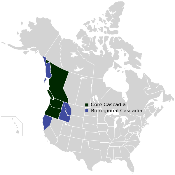
English: Map of the proposed country of Cascadia, incorporating both the political and bioregional models. Català: Mapa de Cascàdia, on s'indica tant el possible estat com la bioregió. |
| Date | |
| Source | Own work |
| Author | Cascadianow |
| Other versions |
File:Cascadia map2.svg has 1 translations.
|

Licensing
I, the copyright holder of this work, hereby publish it under the following license:
This file is licensed under the Creative Commons Attribution-Share Alike 3.0 Unported license.
- You are free:
- to share – to copy, distribute and transmit the work
- to remix – to adapt the work
- Under the following conditions:
- attribution – You must give appropriate credit, provide a link to the license, and indicate if changes were made. You may do so in any reasonable manner, but not in any way that suggests the licensor endorses you or your use.
- share alike – If you remix, transform, or build upon the material, you must distribute your contributions under the same or compatible license as the original.
File history
Click on a date/time to view the file as it appeared at that time.
| Date/Time | Thumbnail | Dimensions | User | Comment | |
|---|---|---|---|---|---|
| current | 18:29, 22 Niġlaalgit Tiŋŋiviat 2023 | | 1,730 × 1,730 (140 KB) | Lalpino | File uploaded using svgtranslate tool (https://svgtranslate.toolforge.org/). Added translation for ca. |
| 22:14, 12 Tiŋmirrat Tatqiat 2012 |  | 1,730 × 1,730 (141 KB) | Cascadianow~commonswiki | {{Information |Description ={{en|1=Map of the proposed country of Cascadia, incorporating both the political and bioregional models.}} |Source ={{own}} |Author =Cascadianow |Date =2012-04-11 |Permission... |
File usage
The following page uses this file:
Global file usage
The following other wikis use this file:
- Usage on ca.wikipedia.org
- Usage on en.wikipedia.org
- Usage on ru.wikipedia.org